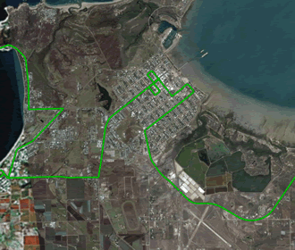
GPS units are handy devices when traveling, you can even pick them up now for less than 200 bucks and it sure beats stuffing around with a range of paper maps. One other thing you can do with many of them is to record a tracklog and then copy that on to your PC and even import it into Google Earth to show off to your friends where you have been. If you want to know more on how to do this follow our brief tutorial after the jump. (Warning: computer tech content follows!)
Firstly you are going to need to have a GPS device that supports recording tracklogs. We use a small Chinese made Windows based device that we got from EBAY, it can run a few different types of GPS mapping software and we have found that some software like I-Go and Miomap support it while others like Route 66 and Destinator don’t.An example of enabling recording tracklogs in I-Go or Miomap is to select the gear or quick menu when you are in map or cockpit mode, now select manage tracklog and then record. Now everywhere you go as long as your GPS is turnt on a track will be recorded, kind of like dropping bread crumbs along a path. Now after you have finished your trip you can go back into the manage tracklog menu and stop recording and then view a replay of where you have been or fit your whole journey to the screen from the info menu.
Also under the info menu is the button we are going to have the most fun with, and this is the export button. When you hit export, the track you are looking at is saved onto the GPS’s memory card in a GPX format. Now its time to connect your GPS or memory card to the computer and copy the file it saved to your computer. You will need to navigate to the directory of your navigation software and find where it saved the file. What you are looking for is the file you exported most likely named track saved at date.gpx generally this will be in a tracks directory, once you find it copy it to your computer.
Now your GPX file is on your computer its time to have some fun with it, GPX is a format that GPS units use for there tracklogs so other bits of software can read them. What we are going to do is convert the GPX file to a format that Google Earth uses (known as KML), and you can do that here http://www.gpsvisualizer.com/map?form=googleearth or with this C_GPS2KML software. Once you have converted the file into a KML you can now open that file up into Google Earth and you should see a track of your journey that you exported from your GPS. (Note: sometimes you can load the GPX file directly into Google Earth without converting to KML, but we found this flakey at times)
So that’s about it, it’s pretty simple once you get the hang of it, our tutorial above is mainly referring to I-Go or Miomap, there are other GPS softwares that support exporting a GPX but we haven’t tried many of them to know what ones do it and how to do it but it should be pretty simple if you follow the manual for your device.
One last thing if you haven’t got google earth you can download it free here http://earth.google.com
The Menu images from Mio Map below


